Shopping Cart
There are no more items in your cart


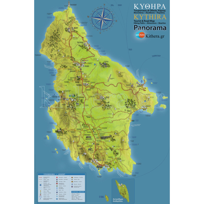
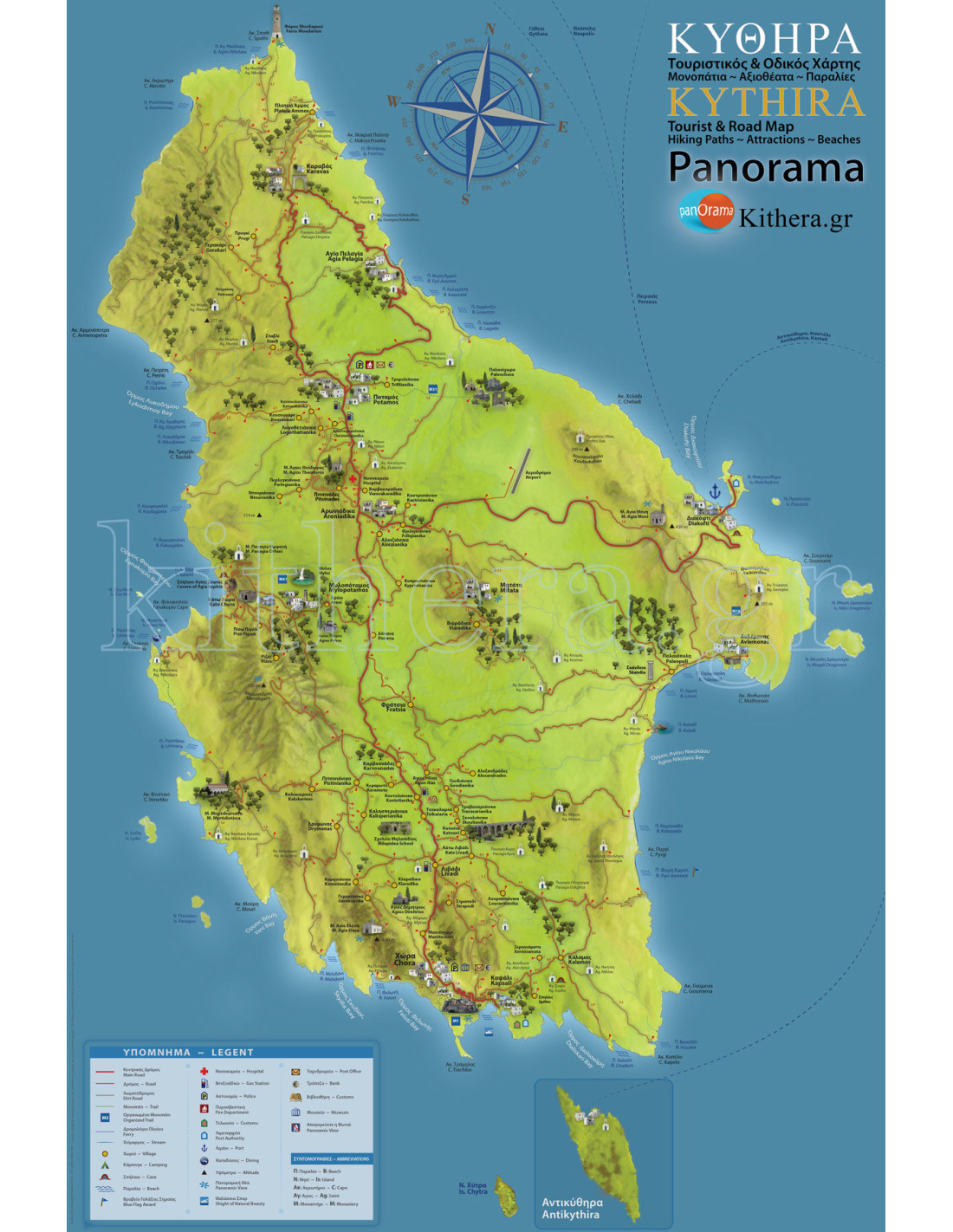
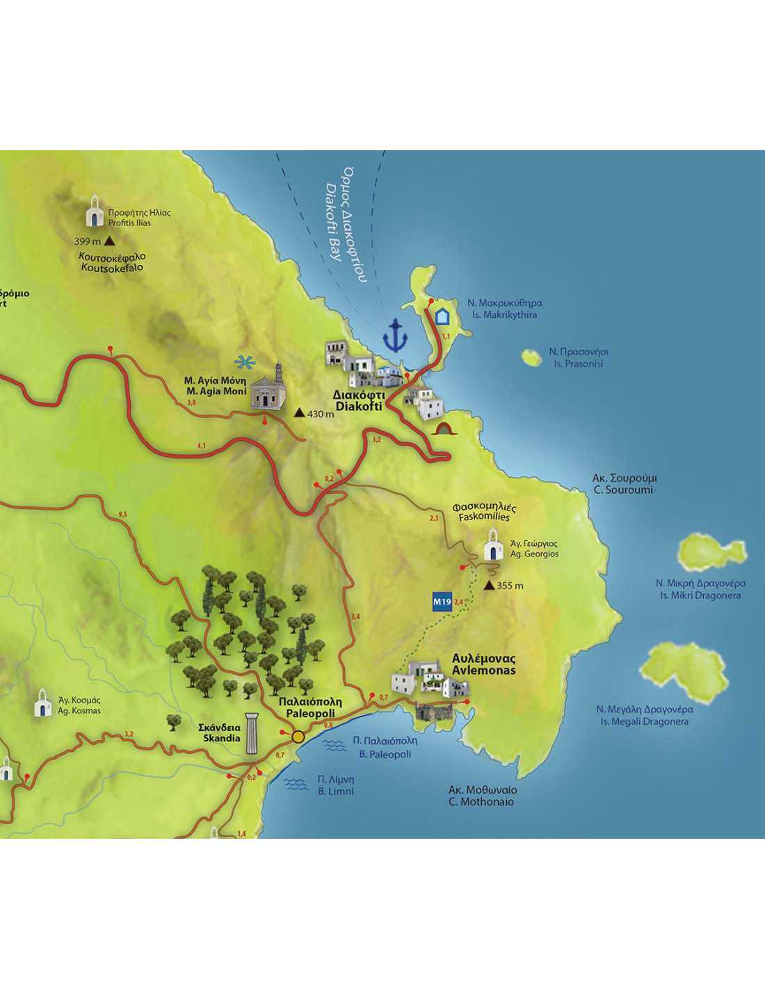
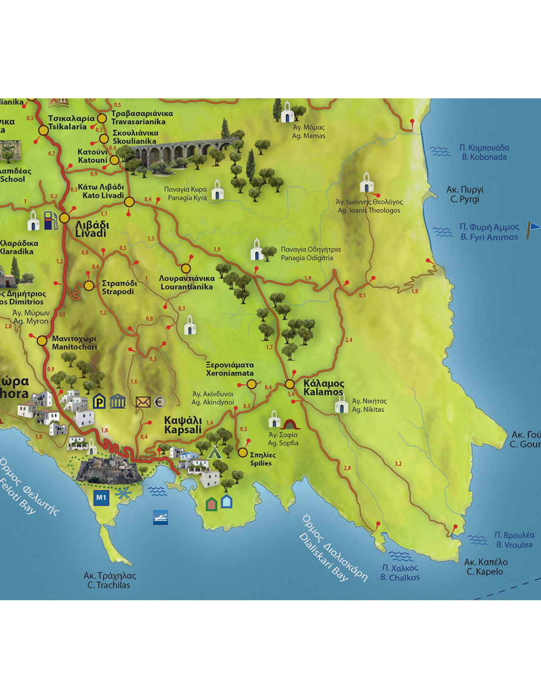
Kythira Map
€5.00
Tax included
Road and Tourist Map of Kythira.
Suitable for all devices.
100% JPEG Quality.
4000X6000 pixels
Discover Kythira guided by a Map!
- All Villages and Settlements, Beaches, Historical Monuments, Natural Areas.
- Includes the signposted Hiking Trails for pleasant journeys on the island of Heavenly Venus.
- Marking with kilometer distances for all routes.
- With realistic representation icons for every major attraction in Kythira.
- High resolution and definition, which allows you to enlarge it as much as you want, for easy and comfortable reading.
- Ideal for all devices, mobile phones, ipad, laptops, pc.
- No internet connection required to access the map, just have the map saved on your device, and it’s always available!
Digital graphic, format: jpg. Download for personal, private and non-commercial use.
Digital files are non-returnable, and no refunds are given under any circumstances.
001
No reviews
Comments (0)
No customer reviews for the moment.
Tap to zoom